Karakterisasi Hidrostratigrafi Berbasis Geolistrik untuk Identifikasi Akuifer di Lereng Timur Gunung Api Ungaran (Geoelectric-Based Hydrostratigraphic Characterization for Aquifer Identification on the Eastern Slope of Ungaran Volcano)
DOI:
https://doi.org/10.59465/jppdas.2026.10.1.107-130Keywords:
Hydrostratigraphy , aquifer , geoelectrical method , Ungaran VolcanoAbstract
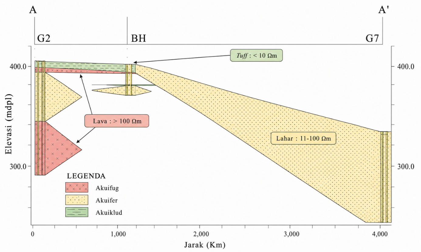
The eastern slope of Ungaran Volcano is an area under high pressure for clean water needs due to population growth and the expansion of residential and industrial areas. This study aims to identify and characterize the aquifer system through a hydrostratigraphic approach that integrates Vertical Electrical Sounding (VES) data from nine measurement points, borehole log data to a depth of 35 m, and geological and geomorphological information. The research results show the presence of two main aquifer systems, namely unconfined aquifers and confined aquifers. The unconfined aquifer is widely distributed in the central and eastern regions, particularly in the geomorphological unit of the Middle Slope Young Ungaran Pyroclastic Flow (VM6), which is dominated by porous lahar deposits. Meanwhile, the confined aquifer is identified in the northeastern zone, characterized by lahar layers trapped between impermeable rock formations of lava and fine tuff. The interpretation of rock resistivity shows that lahar deposits (10–100 Ωm) act as an aquifer, lava (>100 Ωm) as an aquifuge, and tuff (<10 Ωm) as an aquiclude. The 2D and 3D hydrostratigraphic models produced clearly illustrate the spatial distribution of aquifers, where the greatest groundwater potential is found in the eastern, central, and part of the northern regions. In contrast, the western and southern regions are dominated by lava rock, which has low aquifer potential. This finding provides an important scientific basis for the sustainable management and utilization of groundwater resources in volcanic areas.
Downloads
Published
How to Cite
Issue
Section
License
Copyright (c) 2026 Jurnal Penelitian Pengelolaan Daerah Aliran Sungai (Journal of Watershed Management Research)

This work is licensed under a Creative Commons Attribution-NonCommercial-ShareAlike 4.0 International License.